


 #54 – Stanislaus County
Just south of San Joaquin County, Stanislaus County includes many of the same ecosystems in California’s Central Valley. Hiking opportunities are a step up in Stanislaus County because a large segment of the San Joaquin River drainage is protected by the San Joaquin National Wildlife Refuge. Additional, the Orestimba Wilderness portion of Henry Coe State Park, nestled in Califoia’s Coast Ranges, makes up the western reach of the county.
Highlights:
-Take the 4-mile Pelican Trail at the San Joaquin National Wildlife Refuge. Bring the binoculars!
-Catch the Tuolumne River near Modesto on the Mary E. Grogan Grove Trail or near Waterford along the Tuolumne River Parkway.
-Hiking in the remote Orestimba Wilderness portion of Henry Coe State Park. Most of the year it’s a long hike into this remote area, but keep an eye out for Backcountry Weekend in the spring, a time when you can get a little closer with your vehicle.
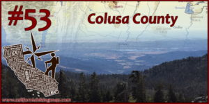 #53 – Colusa County
Ditto Glenn County (almost!) except replace Sacramento National Wildlife with the Delevan and Colusa National Wildlife Refuges. Colusa County also includes a sliver of the Snow Mountain Wilderness (part of the Berryessa-Snow Mountain National Monument) which, on a technicality, includes the final approach to Snow Mountains’s east summit (and high point). Some recovery will need to happen in this area after 2018’s Ranch Fire, part of the Mendocino Complex. The southwest corner of the county includes BLM land adjacent to the Cache Creek Wilderness which shines in the springtime.
Highlights:
-Summiting Snow Mountain from Summit Springs trailhead (if you like long drives) or Deafy Glade (if you like steep hikes).
-Spring hiking among wildflowers on the High Bridge, Brophy Canyon, or Cache Creek Ridge Trails.
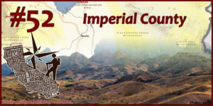 #52 – Imperial County
For many, Imperial County may be the least desirable place to hike in California, especially if you catch it during the summer. If you visit during the cooler months, and have a sense of adventure, the opportunities open up like desert wildflowers. Many off-trail hiking options exist in the various BLM desert wildernesses – just be prepared for rugged conditions.
Highlights:
-Playing on the Algodones Dunes. The area north of Highway 78 is wilderness and the area south of the Highway is an OHV playground.
-Seeing the Salton Sea from Red Hill at the Sonny Bono Salton Sea National Wildlife Refuge.
-Several hundred thousand acres of desert wilderness, including walkable adventures like Davies Valley in the Jacumba Wilderness.
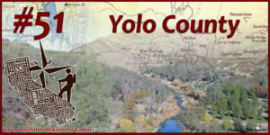 #51 – Yolo County
Yolo County is predominately agricultural, but its location between the Coast Range and the Sacramento River provides a variety of hiking attractions. The Cache Creek area in the northwest part of the county shines during the shoulder seasons while riverside walks along Putah Creek and the Sacramento River are enjoyed year-round.
Highlights:
-Strolling along Putah Creek on the UC Davis trail system, either on the riparian stretch south of campus (Putah Creek Reserve Trail) or through the arboretum stretch on campus.
-Taking the low route along Fiske Creek, or the high route to Fiske Peak on Blue Ridge in the Coast Range.
-Walking one of several loop trails at the Yolo-Bypass Wildlife Area.
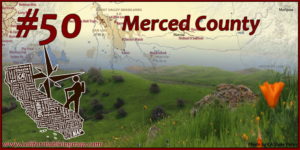 #50 – Merced County
You won’t see too many hiking opportunities right off of Highway 99 and Interstate 5 in Merced County, but sandwiched between the two roads is one of the largest protected wetland areas in California. The San Luis NWR, Merced NWR, Great Grasslands State Park, and private conservation easements protect about 179,000 acres of grassland and wetland. Pacheco State Park is one of the few places where you can go hiking on the east slope of the central coast ranges.
Highlights:
-Hiking up to Spikes Peak in Pacheco State Park. Maybe you’ll spot some Tule Elk?
-Birding in late winter on a pair of 6 mile loop hikes – one in the Kesterson Unit of San Luis NWR, and one in Great Grasslands State Park.
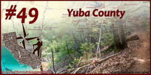 #49 – Yuba County
Yuba County has one foot in the Sacramento Valley and the other in the Sierra Nevada foothills. The largest trail system is along New Bullards Bar reservoir in Tahoe National Forest, but a patchwork of private landowners, land trusts, and state wildlife areas have been expanding the availability of hiking experiences in Yuba County.
Highlights:
-Taking the new (2015) Yuba Rim Trail, built by the Bear Yuba Land Trust, to a great view of the confluence of the Middle and North Forks of the Yuba River.
-Taking the Collins Lake trail system into the Daugherty Hill Wildlife Area.
-Finding some shade on one of several loop options at New Bullards Bar Reservoir.
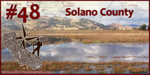 #48 – Solano County
Solano County is the gateway between the San Francisco Bay Area and the Sacramento Valley so there are certainly a wide variety of environments. Hiking opportunities exist in the marsh and wetland areas near San Pablo Bay, Carquinez Strait, and Grizzly Bay, in the Vaca Mountains, and along the rolling hills in between.
Highlights:
-Stebbins Cold Canyon Reserve, operated by UC Davis. Recovery will need to occur after recent wildfires.
-Suisun Hill in Rush Ranch is an easy climb, but offers a huge view of California’s largest marsh.
– Accessing the Bay Area Ridge Trail at Blue Rock Springs Park, Lynch Canyon Open Space Park, or Rockville Hills Park.
 #47 – Sacramento County
Host to the State Capitol, Sacramento County certainly has enough urban walks, jogs, kayaks, and trail runs to keep you moving all day – both on singletrack and paved surfaces. The southern corners of the county also have beautiful hikes showing off the natural side of California’s Central Valley.
Highlights:
-The American River Parkway – stretching nearly 30 miles from the Sacramento River to Folsom Lake. The Jedediah Smith Trail offers quick paved access to dirt singletrack at several of the “bars” along the American River.
-Walking through California’s largest valley oak riparian forest at Cosumnes River Preserve.
-Enjoying wildflowers and vernal pools along the Howard Ranch Trail at the Rancho Seco Recreational Area.
 #46 – Lake County
Wildfires are a part of California, sometimes with devastating consequences. Lake County, acting as a bridge between a variety of Northern California ecosystems, has seen more fire activity than most places in the country. That said, many of the hiking destinations in Lake County show off the land’s ability to recover after fires – especially during the spring.
Highlights:
-Winding up Mount Konocti (actually a volcano!) up to the fire lookout on Wright Peak for big views.
-Descending into Wilson Valley via the Redbud Trail in the Cache Creek Wilderness.
-Watching for wildlife and enjoying fall colors around Anderson Marsh.
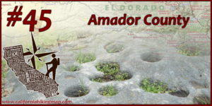 #45 – Amador County
Amador County stretches from gold-country foothills to the Carson Pass area of the Sierra Nevada Mountains. There are a few trails alongside reservoirs at the lower elevations, but the high country of Amador County really shines. Indian Grinding Rock State Park, near the middle of the county, is a worthy visit.
Highlights:
-Hiking through green grass and wildflowers (during the spring) on the China Gulch Trail along Camanche Reservoir’s north shore.
-Taking Tanglefoot Canyon into the Mokelumne Wilderness (to Shriner Lake, or cross-country to Mokelumne Peak).
-Hiking up Thunder Mountain, the highest point in Amador County, for big views of Silver Lake and the surrounding Carson Pass area.
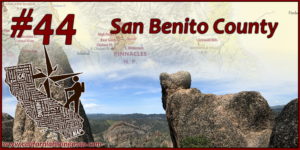 #44 – San Benito County
Nestled in California’s central coast ranges, San Benito County has the quintessential California countryside look. Vaulting San Benito County this high on this list is the presence of one of the most magnificent hiking experiences in the state – Pinnacles National Park.
Highlights:
-The historic stretch of the San Juan Bautista De Anza Trail along Old State Road near Hollister.
-Hiking to Laguna Falls in the BLM Laguna Mountain Recreation Area (get there before June!).
-Did I mention Pinnacles National Park yet?

#43 – San Francisco
San Francisco is California’s only City / County combo (not a strange concept to this former Virginian). Although it’s the State’s smallest county, San Francisco has hiking trails that show off some of the most well-known urban landscapes in the country. There are pockets of natural landscapes here and there, but San Francisco shows that urban hiking can and will be enjoyed by many.
Highlights:
-Hiking along the California Coastal Trail segments in Lands End and the Presidio. Hello Golden Gate Bridge and great ocean views (when it’s not foggy)!
-Meandering around Golden Gate Park with dozens of loop options.
-Experience saltwater and freshwater views by combining Lake Merced with the Fort Funston trails.
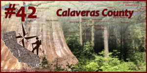
#42 – Calaveras County
Calaveras County contains a large swath of picturesque Sierra Nevada foothills (book-ended by large reservoirs) and climbs briefly into the high country. The central portion of the county includes dense forested areas, including one of California’s most famous Sequoia groves.
Highlights:
-Seeing Giant Sequoia trees and hiking down to the Stanislaus River at Calaveras Big Trees State Park.
-Pick a flavor of the Mokelumne Coast to Crest Trail – either the high country section with views of Salt Springs Reservoir or the foothill section bursting with spring wildflowers.
-Getting a work out with views on the lengthy Arnold Rim Trail.
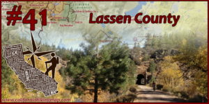
#41 – Lassen County
Four counties get to share Lassen Volcanic National Park. Lassen County gets the less visited but still amazing northeast corner of the park. The landscapes are truly unique here, where the Cascades, the Sierras, and the Great Basin meet.
Highlights:
-Spiraling up Cinder Cone and viewing the Painted Dunes in Lassen Volcanic National Park.
-Finding dozens of lost lakes surrounded by pine and juniper in the Caribou Wilderness.
-Coasting down the Bizz Johnson Trail into Susanville while enjoying fall colors along the Susan River.
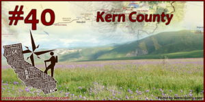
#40 – Kern County
Kern County is big – from Los Padre National Forest land in the Transverse Ranges, to the southern extent of the Sierra Nevada Mountains, to the Mojave Desert. Most just see the Central Valley portion of the county – but there is a lot of room here to hike some major miles.
Highlights:
-Spring wildflowers and views of the Kern River Canyon along the Kern River / Kern Canyon / Badger Gap Trails in Sequoia National Forest.
-Tumble around the Rademacher Hills or ascend Owens Peak – and you’ll feel really far from Bakersfield.
-Kern County has about 140 miles worth of the Pacific Crest Trail. The area around Walker Pass combines pine trees with Joshua trees.
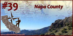 #39 – Napa County
Napa County is known for vineyards, wineries, and amazing volcanic cliffs. Oh, you didn’t know about that last one? There are hikes through small groves of coast redwood and plenty of miles of trails through oak woodlands. Note that recent wildfires have impacted many locations in Napa County so check for closures and tread lightly.
Highlights:
-The one way shuttle hike from Table Mountain to Calistoga in Robert Louis Stevenson State Park through the Palisades is a classic adventure.
-Walking along Richie Creek in Bothe-Napa Valley State Park.
-One of several loop options through oak woodlands and foothills at Skyline Wilderness Park – connected to the city of Napa by the River to Ridge Trail.
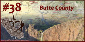 #38 – Butte County
Did I give Butte County a bump just because it’s been my home for about 10 years? I don’t think so. There are stellar hikes ranging from the Sacramento Valley floor into the foothills where the Sierra Nevada and Cascade mountains meet.
Highlights:
– Hiking in Chico’s Upper Bidwell Park while enjoying spring wildflowers or summer swimming holes.
– Wading through wildflowers on Table Mountain while searching for phantom waterfalls.
– The hike to Feather Falls – CA’s highest north of Sacramento. This trail may need a few years of recovery after wildfires but the falls will be there waiting.
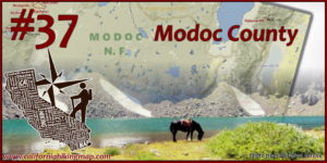 #37 – Modoc County
Closer to Boise than San Francisco, Modoc County is a world away. The hiking is pretty far out as well, especially with the sky island known as the Warner Mountains.
Highlights:
-The lengthy Summit Trail in the Warner Mountains provides access to the scenic Warren Peak area (on the north side) as well as the county high point Eagle Peak (on the south side).
-The Ash Creek State Wildlife Area is one of the most remote and pristine wildlife areas in the state.
-Hiking California’s northeastern-most trail – the Highgrade National Recreational Trail near the prominent Mount Vida.
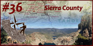 #36 – Sierra County
Sierra County is the heart of the “Lost Sierra” and the trails are generally remote and sparsely used. The big exception is during Downieville Downhill days where you can see mountain bikers take the reign.
Highlights:
-Hiking, then stair-stepping, up the Sierra Buttes to one of the most scenic fire-lookouts in the state.
-The trail system branching out from Downieville, including the North Yuba Trail and the Downieville Downhill sections, is gorgeous. Just be ready to yield to bombing mountain bikes!
-You can access the PCT in Sierra City and above Packer Lake for scenic section hikes.
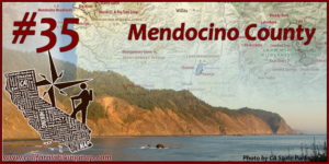 #35 – Mendocino County
Mendocino County covers large stretches of California’s North Coast and Northern Coast Ranges – with valleys, towns, redwood groves, and trail opportunities sprinkled here and there. The drive to your hike will likely be winding but worth it.
Highlights:
-The cluster of Van Damme State Park, Russian Gulch State Park, and Jug Handle State Reserve offers beach hikes and trails that follow redwood-lined creeks.
-The Lost Coast Trail in Sinkyone Wilderness State Park provides a more rugged but less populated alternative to the Kings Range stretch to the north.
-Hendy Woods State Park and Montgomery Woods State Reserve show off how old-growth redwood groves can thrive far from the ocean.
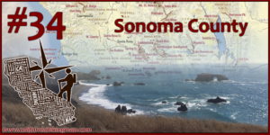 #34 – Sonoma County
Sonoma County has a variety of public open spaces spanning from the coast to inland coastal ranges dotted with oak woodlands. As with many locations in California, wildfires have temporarily closed several popular areas (Armstrong Redwoods / Austin Creek, Hood Mountain).
Highlights:
-Hiking with ocean views at Salt Point SP or Sonoma Coast SP.
-Trione-Annadel SP & Jack London SHP have quintessential California oak & grassland scenery (which means great wildflowers too) just outside of Santa Rosa.
-Lake Sonoma has an extensive trail system long enough to stretch your legs.
 #33 – Plumas County
Plumas County is where the Northern Sierra meld into the Southern Cascades, but not before being bisected by various forks of the Feather River.
Highlights:
-The Lakes Basin Recreation Area is kind of the Sierra Nevada’s last hurrah going north of big granite landscapes.
-…until you get to the Spanish Peak area along the PCT – with access to Silver Lake and the Bucks Lake Wilderness.
-The Feather River Canyon is one of my favorite drives and there are several hiking options near and in the town of Belden – including the PCT.
-On a technicality, Mount Harkness in Lassen Volcanic National Park is also in Plumas County.
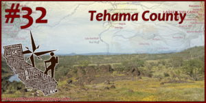 #32 – Tehama County
Rugged Tehama County is home to miles and miles of trails that are tough, hard to get to, sometimes hard to find, and/or unknown. Chances are they are beautiful though. The county is divided by the northern Sacramento Valley and bracketed by the northern Coast Ranges and the southern Cascades.
Highlights:
-South Yolla Bolly / Mount Linn is the highest point in California’s Coast Ranges and is a great introduction to the Yolla Bolly Wilderness. Recent wildfires will lead to some closures so check before you go.
-There are great winter/spring hiking & backpacking options at the Sacramento River Bend BLM Area, and (if you’re into remote, rough, but rewarding hiking) the Ishi Wilderness.
-Many of Lassen National Volcanic Park’s south entrance attractions (Brokeoff Mountain, Mill Creek Falls) are in Tehama County!
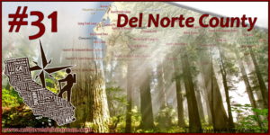 #31 – Del Norte County
Many coastal counties in Northern California feature redwood trees, but many say that the most majestic trees can be found in Del Norte County. Wilderness experiences can be had as well along the Smith River and in the west side of the Siskiyou Mountains.
Highlights:
-Walks among the redwood trees at Jedediah and Del Norte Coast Redwoods State Parks.
-Catching one of the Coast Trail sections between Crescent City and Klamath for big ocean and forest scenery.
-Hiking alongside the Wild and Scenic Smith River on the South Kelsey National Recreational Trail.
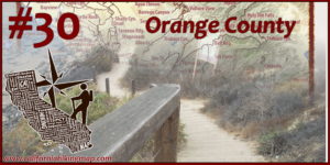 #30 – Orange County
Orange County may seem like a densely populated area with not much room to hike – but there is a surprisingly large network of hiking trails, open spaces, and bike trails that connect the ocean to the Santa Ana Mountains.
Highlights –
-The trio of Crystal Cove State Park, Laguna Coast Wilderness Park, and Aliso and Wood Canyons Wilderness Park provides California’s largest coastal hiking area south of LA.
-Visiting Holy Jim Falls (Cleveland National Forest) on the way to Santiago Peak – Orange County’s high point.
-Caspers Wilderness Park has a lot of room to roam and has some of the best spring wildflower shows in Orange County.
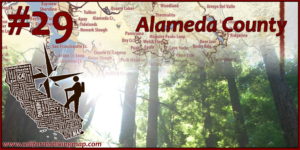 #29 – Alameda County
The East Bay has a major trail system (largely hosted by East Bay Parks), and about half of it is in Alameda County. As with many Bay Area counties, you’ll have some wetlands, some wooded & grassy hills, and even redwood groves sprinkled in.
Highlights:
-The Ohlone Wilderness Trail is one of the longest hiking adventures in the Bay Area. Each end (Del Valle and Mission Peak) and the Sunol area offer shorter trips too. Permits required.
-Hikes in Anthony Chabot Regional Park, Redwood Regional Park, and Joaquin Miller Park (all connected) can take you deep into a natural setting just minutes away from the city.
-Birders may enjoy plenty of wetland species and scenic walks at Coyote Hills Regional Park and Eden Landing Ecological Reserve.
 #28 – Santa Clara County
Silicon Valley is wrapped on almost all sides by great hiking opportunities – with the western sections in the Santa Cruz Mountains offering dense forests while the eastern side features the oak-studded hills of the central coast ranges.
Highlights:
-Henry Coe State Park is one of the largest State Parks in California with lots of room to roam. Check for wildfire-impacted closures before you go.
-The trio of Levin, Alum Rock, and Joseph D. Grant Parks east of San Jose can provide great views of the city or open space depending on which trail you take.
-Castle Rock State Park is the start of the Skyline to the Sea experience and a pit stop along the Bay Area Ridge Trail & Skyline Trail, but it also has several great short hikes as well.
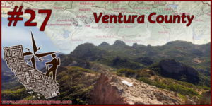 #27- Ventura County
Ventura County may be known for its beachside destinations, but there is a lot of wilderness and amazing geology in the backcountry too.
Highlights:
-The western end of the Santa Monica Mountains, including Point Mugu State Park and Circle X Ranch has trails with interesting geology, plants, and ocean views.
-The Ventura River Preserve and adjoining preserves managed by Ojai Valley Land Conservancy showcase a variety of ecosystems.
-Hiking along the Sespe River to find unique landscapes and hot water.
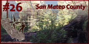 #26 – San Mateo County
San Mateo County is located where the Santa Ana Mountains meet the San Francisco Peninsula. The part of the county by the Bay is largely urbanized, but the mountainous areas in the central and coastal portions of the county have a lot of protected lands with great hiking opportunities.
Highlights:
-The Midpeninsula Regional Open Space District operates a chain of beautiful preserves along the skyline of the Santa Cruz Mountains – accessible from scenic but winding Skyline Blvd.
-Redwoods can be visited at Portola Redwoods and Butano State Parks. The area was impacted by wildfire so check before visiting.
-There are several areas to hike by the coast – notably Año Nuevo and Montara State Beach.
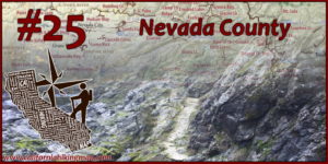 #25 – Nevada County
Nevada County cuts through the Northern Sierra Nevada Mountains and has hiking trails that sample a full spectrum ecosystems – gold country foothills, forested ridges & canyons, granite high-country, and sagebrush meadows.
Highlights:
-The Donner Summit area is great for short hikes (perhaps to Castle Peak) or hopping onto the PCT. Trails at Donner Memorial State Park are easy and great for families.
-Taking a walk along the South Fork of the Yuba River. There are a lot of places to do that too – from the Point Defiance Loop to the lengthy South Yuba Trail.
-Hopping from granite-lined lake to granite-lined lake in the Grouse Ridge area.
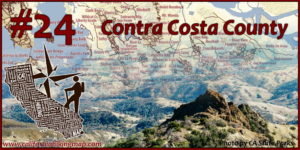 #24 – Contra Costa County
As urban & suburban as Contra Costa County is, there is a dense network of trails that connects most corners of the county. Contra Costa also has the centerpiece of the Bay Area’s stretch of the Coast Ranges – Mount Diablo.
Highlights:
-Catching the huge view from the top of Mount Diablo on a clear day.
-The duo of Tilden and Wildcat Canyon Regional Parks combine for longer hikes – and the East Bay Skyline NRT helps connect to other parks further south.
-The eastern side of the county includes the Los Vaqueros Watershed and Black Diamond Mines which put on a great display of spring wildflowers.
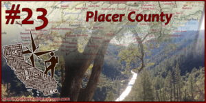 #23 – Placer County
Similar to its neighbors to the north and south, Placer County has hiking options in the foothills, in forested canyons, and in the high-country. Making Placer County extra special is the top half of Lake Tahoe and the exceptionally deep canyons of the Northern Forks of the American River.
Highlights:
-The PCT, Tahoe Rim Trail, and the Granite Chief Wilderness are all in reach around the Squaw Valley area.
-Hidden Falls Regional Park and the Auburn State Recreation Area are good low-elevation options during cooler weather.
-The North Fork of the American River above Auburn has several trails leading into the Canyon. The Stevens Trail near Colfax is a good introduction while trails in the Royal Gorge area (like Palisades Creek) are quite strenuous.
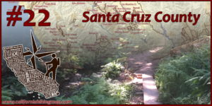 #22 – Santa Cruz County
Dense forests, redwoods, and sea-side ridgetops highlight the hiking in Santa Cruz County. Much of the western half of the county, including almost all of Big Basin Redwoods State Park, was impacted by wildfire and recovery will take some time. That said, there are other amazing destinations in the meantime.
Highlights:
-The Forest of Nisene Marks & the Soquel Demonstration Forest shows how California forests can regenerate, in a protected manner and in a timber management manner respectively. This area is popular with mountain bikers too.
-If you’re seeking some sun (or fog), Wilder Ranch State Park has trails with great ocean views.
-While Big Basin is in recovery, Henry Cowell Redwoods State Park has a grove of old-growth redwoods that are great to visit.
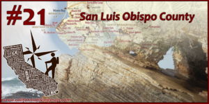 #21 – San Luis Obispo County
At the heart of California’s Central Coast, San Luis Obispo county is a day-hiking treasure with a look and feel that’s quite unique. Sand dunes, volcanic plugs, and the San Andreas Fault laid bare add variety to classic California scenery.
Highlights:
-Several Nine Sisters between San Luis Obispo and Morro Bay are hikable and can give great inland views (Bishop Peak / Cerro San Luis) or coastal views (Black Hill, Cerro Cabrillo).
-Montaña de Oro State Park has easy walks along the bluff and challenging climbs. Both show off the rugged Central Coast.
-Chaparral and patches of forested lands can be explored on Los Padres National Forest Land, including at Cerro Alto and in the Santa Lucia and Machesna Wildernesses.
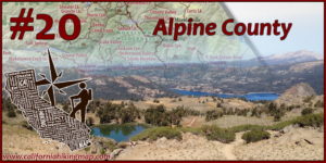 #20 – Alpine County
The road to Alpine County in the Sierra Nevada is winding and, in the winter, often saddled with snow. It’s a small and sparsely populated county, but that’s what makes it special.
Highlights:
– The Carson Pass area has access to many alpine lakes, peaks (like Round Top), the PCT, and the Mokelumne Canyon.
-The road to Ebbetts Pass (Highway 4) also has access to many trails, especially around the Lake Alpine area (Inspiration Point is a short climb from Lake Alpine).
-The Carson-Iceburg Wilderness covers much of the land between Ebbetts Pass and Sonora Pass and has many high lakes and uniquely shaped and colored peaks. The PCT cuts right through the wilderness.
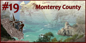 #19 – Monterey County
Monterey County is known for amazing drives (hello Big Sur Coast and Pebble Beach) but there are plenty of trails that give the same sense of wonder. Trails further inland include chaparral, oak woodlands, and California’s southernmost groves of redwood trees.
Highlights:
-The Big Sur coast is lined with state parks with access to redwood groves (Pfeiffer Big Sur SP, Julia Pfeiffer Burns SP, Lime Kiln SP), coastal waterfalls (McWay Falls), and great ocean views (especially at Andrew Molera SP).
-The crowds usually thin out quickly in the backcountry of the Ventana Wilderness and the Silver Peak Wilderness. There are still active wildfire closures in some areas to check before you go.
-When the coast is fogged out – Garland and Toro Regional Parks usually has more sunshine and – in the spring – great wildflowers.
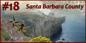 #18 – Santa Barbara County
Located where the Southern California coast bends north towards the Central Coast, Santa Barbara County has a great variety of scenery. Although there are great trails near the City of Santa Barbara, the majority of trails lie in difficult to reach areas which helps keep the experiences wild.
Highlights:
-The Jesusita Trail and Rattlesnake Canyon Trail are popular (and often busy) ways to ascend into the Santa Ynez Mountains from Santa Barbara.
-Backcountry destinations in the Los Padres National Forest’s San Rafael Wilderness – such as the Sisqoc/ Manzana river valleys, and Big Pine Mountain take some hefty mileage to approach but offer more solitude.
-The majority of Channel Islands National Park is in Santa Barbara County – and includes great day-hikes and backcountry trips. Catch a boat ride!
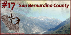 #17 – San Bernardino County
My first home in California, these are the trails that made me fall in love with hiking! San Bernardino County is the Lower 48’s largest county so there is plenty of room to explore. The San Bernardino Mountains and the eastern edge of the San Gabriel Mountains have forested and high-country hikes while there are some trails, and lots of open-country hiking opportunities in the Mojave Desert.
Highlights:
-San Gorgonio Mountain is the highest peak in Southern California and can be summited from a variety of trails within the San Gorgonio Wilderness – part of the Sand to Snow National Monument
– Some of the best views of interior Southern California come from Cucamonga Peak and Mount Baldy (which is shared with LA County).
– The Mojave National Preserve (including the Kelso Dunes) and the northern (and more developed) third of Joshua Tree National Park are in San Bernardino County.
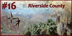 #16 – Riverside County
When it comes to variety – Riverside County might be at the top of the list with hiking options in the Santa Ana Mountains, Inland Empire, San Jacinto Mountains, the Coachella Valley, and the Mojave Desert.
Highlights:
-San Jacinto Peak is one of the most scenic summits in California, with lots of ways of getting there (tram ride from Palm Springs or hiking from Idyllwild).
-Indian Canyons on Agua Caliente lands is a great place to hike by a palm oasis with views of snow-capped mountains.
-Less than 15 miles from the ocean, the San Mateo Canyon Wilderness feels much farther away (probably because the best access is from the eastern side).
 #15 – Madera County
There are three main regions of Madera County – the San Joaquin Valley portion which has limited hiking opportunities, the foothill areas around Oakhurst with a smattering of trails, and the High Sierra which has some of the best hiking destinations in the entire state. Much of the upper San Joaquin River watershed was impacted by the Creek Fire, so check before you go.
Highlights:
-At lower elevations, the Willow Creek trail near Bass Lake features the scenic Angel Falls and Devil’s Slide. Hikes along the northern rim of the San Joaquin River gorge, such as the Pa’San Ridge Trail, pop with wildflowers in the spring.
-It’s easy to think that Devil’s Postpile, Reds Meadow, and Rainbow Falls are in Mono County, but the they make up the eastern-most part of Madera County.
-The Minarets include some of the most iconic peaks in the High Sierra, while the lakes along their eastern flanks are some of the most picturesque lakes in California.
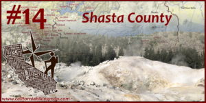 #14 – Shasta County
The high point of Shasta County is (no, not Mount Shasta) Lassen Peak (which is not in Lassen County, of course). Shasta County covers the northern edge of the Sacramento Valley and is wrapped by the eastern flank of the Klamath Mountains and the Southern Cascades.
Highlights:
-You can hike or bike all the way from Shasta Dam to downtown Redding along the Sacramento River Trail. The trails and waterfalls of Whiskeytown National Recreational Area are close by too – and are recovering after recent wildfires.
-Lassen Peak and Bumpass Hell are the highlights of Lassen Volcanic National Park, but there are many other trails that take you further from civilization.
-North of Lassen Peak, the Pacific Crest Trail passes by several great hiking destinations in Shasta County including the Subway Cave, Hat Creek Rim (hey, it’s nice in the spring), Burney Falls, and Castle Crags.

#13 – San Diego County
No matter where you go in San Diego County, whether it’s into the Peninsular Ranges, down in the Sonoran Desert, or by the coast, there’s likely hiking opportunities nearby. It’s also the southern terminus of the Pacific Crest Trail.
Highlights:
-East of of the pacific crest, in Anza-Borrego State Park, Borrego Palm Canyon is a nice shorter hike for beginners while the route to Goat Canyon Trestle adds a little more challenge and remoteness.
-In the high country, there’s the PCT – which also connects into the 100+mile trail network of Cuyamaca Rancho State Park.
-The hills east of Poway are not huge but they can lead to big views, especially on El Cajon Mountain and Mount Woodson.
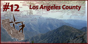 #12 – Los Angeles County
The nation’s most populated county is home to iconic hikes and even several wilderness areas. The Transverse Ranges dominate the high country while smaller ranges like the Santa Monica Mountains add to the variety of landscapes. Don’t forget the Mojave Desert part of the county!
Highlights:
-Mount Baden-Powell, Mount Wilson, and Mount Baldy (San Antonio) are three tremendous peaks with big views on clear days. All three are part of the Angeles National Forest
-Griffith Park and Kenneth Hahn SRA are two urban parks with iconic views of downtown LA and the surrounding areas.
-A string of State Parks (Topanga, Malibu Creek, Leo Carrillo) are embedded within the Santa Monica Mountains National Recreation Area providing many trails with ocean views. Speaking of the ocean, don’t forget Catalina Island!
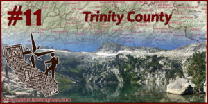 #11 – Trinity County
If I wasn’t trying to be slightly objective and relied purely on my own experiences, Trinity County would probably be my #1. The Trinity Alps take center stage here, part of the Klamath Mountains. Trinity County also includes the northern reaches of the Northern Coast Ranges of California.
Highlights:
-Most of the Trinity Alps Wilderness lies within Trinity County – including adventures along Canyon Creek, Stuart Fork, and Swift Creek.
-Mount Eddy is a generally unassuming peak by itself, however it’s the highest peak in the Klamath Mountains, Trinity County, and anywhere in the continental US west of I-5! It also has one of the best 360 degree views in all of Northern California. The hike in also features the Deadfall Lakes and an intersection with the PCT.
-Black Rock Mountain and North Yolla Bolly (hike them together!) are two peaks within the Yolla Bolly Wilderness that have excellent views, are off the beaten path, and seemed to have escaped the worst of the August Complex fire.
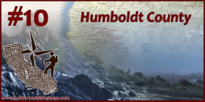 #10 – Humboldt County
Kicking off California’s top 10 counties for hiking, Humboldt County is known for big coastal vistas and many of California’s largest and tallest redwood groves. The eastern portion of the county also includes remote conifer country in the Klamath Mountains.
Highlights:
-Redwood National Park – with beach-side walks and redwood hikes – is a wonder to visit, but Prairie Creek Redwoods State Park right next door may be even more exciting!
-The largest remaining grove of old-growth redwood forest in the world is at Humboldt Redwoods State Park.
-Trinidad State Beach is a highlight when it comes to short but amazing walks by the beach. The Lost Coast Trail in the Kings Range is one of the nation’s best coastal wilderness adventures.
 #9 – El Dorado County
Gold rush ground zero – El Dorado County has been attracting hikers for a long time. El Dorado has a classic Northern Sierra gradient of foothills, densely forested canyons, and high country. Hiking in the eastern quarter of the county usually includes views of Lake Tahoe.
Highlights:
-The Auburn & Folsom Lake State Recreational Areas are popular while wildflowers are popping and the high country is still snowed in. Wildflowers are also a draw on BLM managed lands along the South Fork of the American River (wave at the rafters!).
-The Desolation Wilderness is one of the nation’s most popular wilderness areas to visit – for a good reason. Point peaks, blue lakes (including some of the best views of Lake Tahoe), and access to the PCT are huge draws.
-One of the best hikes along the shore of Lake Tahoe is the Rubicon Trail, which connects D.L. Bliss and Emerald Bay State Parks.
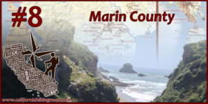 #8 – Marin County
Throw a rock (don’t) in Marin County and you’ll probably hit a trail. It’s packed tight with amazing views of redwood groves, oak woodlands, the City, and the Pacific Ocean. If this was a list ranking trail density – Marin would be #1 hands down.
Highlights:
-Point Reyes National Seashore has many loop and out and back options. My favorite is the trek from Bear Valley to Wildcat Camp (quick diversion south to see Alamere Falls), north to Coast Camp, and back.
-Mount Tamalpais is the heart of Marin County – and trails orbit around the peak (and State Park) with connections to Muir Woods National Monument and Golden Gate National Recreation Area. Many trails are fantastic – I like the Matt Davis / Steep Ravine Loop on the west flank of the area.
-Angel Island – mostly in Marin County – hike hiking and biking options all around the island. Each corner of the island takes you to a different time in history – and the peak on Mount Livermore has great views of the surrounding area.
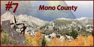 #7 – Mono County
Sagebrush, aspen groves, and dramatic geology are common features of the trails in Mono County. Mono County is a great hiking destination in the summer, but there’s a narrow window in early autumn where Eastern Sierra fall colors are absolutely stunning.
Highlights:
-There are many locations in Mono County where you can park at a lake (like Silver Lake, Convict Lake, Twin Lakes, Lundy Lake, or Lake Mary) and hike to even higher lakes in either the Hoover Wilderness or the John Muir Wilderness.
-Mono Lake, one of the oldest lakes in the country, is a strange and strangely beautiful landscape with a short hike on the southern shore near another short-but-scenic hike at Panum Crater.
-One of the first trails to melt out in the spring in Mono County, and one of the last to get snowed on, is the Lower Rock Creek Canyon Trail. Popular with bikes too!
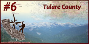 #6 – Tulare County
You wouldn’t know it driving through Pixley (although check out the National Wildlife Refuge nearby) but this is the land of the world’s single largest living thing – and the tallest mountain in the lower 48 (shared with Inyo County). The eastern half of Tulare County is an almost solid wall of National Monuments, National Parks, and wilderness areas anchoring the southern Sierra Nevada mountains.
Highlights:
-Sequoia National Monument – largely south and west of the National Park – boasts 33 giant sequoia groves. The Summit Trail near Slate Mountain and the Needles Lookout are not the highest points in the county – but still have big views.
-The southeast corner of Tulare County is dominated by three wilderness areas with many lightly-traveled trails – Domeland, South Sierra, and Golden Trout. All three wildernesses (and the block of wilderness areas to the north) are connected to the PCT.
-The Sequoia portion of Sequoia / Kings Canyon National Park is truly the centerpiece of hiking in Tulare County. After seeing the General Sherman Tree, Moro Rock takes you up high, Alta Peak takes you higher, and the High Sierra route to Mount Whitney takes you as high as you can go in California.
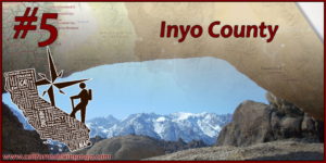 #5 – Inyo County
You’ll likely never forget your first drive up Highway 395 between the Eastern Sierra escarpment and the Inyo Mountains. While you’re driving – it’s only about two hours between Lone Pine, under the gaze of Mount Whitney, to the lowest point in North America. There will be plenty of room to hike around when you get out of the car – with wilderness acres adding up to the several millions.
Highlights:
-The eastern escarpment of the Sierra Nevada Mountains has trailheads every few dozen miles or so leading into the John Muir Wilderness. Some trails dead end at lakes bounded by cliffs, but others continue over passes (like Kearsarge, Taboose, Bishop, and Mono) connecting to the PCT. The most well known and worn pass is Whitney Portal, the quickest way to ascend to Mount Whitney.
-Most of the trails in Inyo County are moderately to extremely strenuous – but an easy yet amazing hiking experience exists in the Alabama Hills just outside of Lone Pine. It really has that wild west look.
-Death Valley National Park is huge, with the lower 48’s largest wilderness area. There are several established “trails” – like the trip to Telescope Peak – but many of the hikes are cross-county or within narrow canyons. Easier walks are close to the roads (like Badwater Basin) but wilderness hiking options are almost limitless. Risks shoot way up with heat or stormy weather.
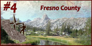 #4 – Fresno County
When I was still somewhat new to California, I once drove around Pine Flat Reservoir and camped around Camp 4 along the King River. It was in March and the wildflowers were going nuts. I know better now – but I thought it was like that all the time in the Sierra Foothills. It’s still magical though. A few years later, I also chose Fresno County as my 2nd backpacking trip with my wife – the Rae Lakes Loop. Folks don’t normally associate Fresno with hiking – but the county it’s home to many highlight reels of the PCT & John Muir Trail.
Highlights:
-The Kings Canyon Portion of SEKI is home to impressive sequoia tree groves (barely though – the General Grant tree is less than a mile from Tulare County) and fantasy-land backcountry trails.
-North of Sequoia Kings Canyon NP, the Ansel Adams, Dinky Lakes, Kaiser, and John Muir Wildernesses continue the impressive string of Sierra Nevada wilderness areas – but check for temporary closures near the upper San Joaquin River drainage due to the Creek Fire.
-A little closer to the City of Fresno – the San Joaquin River trail hovers over the south side of the San Joaquin River gorge and is a good bet for wildflowers while the higher trails are snowed in.
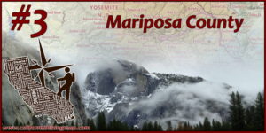 #3 – Mariposa County
Yosemite National Park is shared by three counties (and borders a fourth) but Yosemite Valley, and pretty much the center of gravity of outdoor recreation in all of California, is in Mariposa County.
Highlights:
-Before heading into Yosemite, there’s plenty of hiking outside the park in BLM and National Forest land. Adventures along the Merced River outside of Briceburg and South Fork (Hite Cove) feature lots of wildflowers in the spring.
-Yosemite Valley is the main highlight for Mariposa County, if not the entire state. There’s lots to do up in the surrounding plateaus and canyons – and don’t forget the Mariposa Grove of sequoia trees!
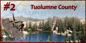 #2 – Tuolumne County
It’s pretty hard ranking these counties – at this point it’s almost comparing apples to oranges! Any county in the top 10 could be my #1 depending on the season and my mood. Tuolumne County is sneakily one of the best counties in the state for hiking – mainly due to the enormous granite playground that is Northern Yosemite and the Emigrant Wilderness.
Highlights:
-The Red Hills BLM Area and Jamestown’s Table Mountain are great stops in the springs for wonderful foothill wildflower displays.
-Tuolumne Meadows in Yosemite National Park is the hub for many adventures in Northern Yosemite – including the Grand Canyon of the Tuolumne, connections to the northbound PCT, and the John Muir Trail’s path south through Lyell Canyon.
-The white & grey granite of the central Sierra Nevada Mountains transitions to volcanly-sourced colors around the Sonora Pass. One way to experience this is walking from Kennedy Lake over to Emigrant Lake.
 #1 – Siskiyou County
The top of this list sits at the top of California. Siskiyou County has an incredible volume and diversity of hiking options – from the six different wilderness areas in the Klamath Mountains threaded together by 150+ miles of the PCT, to the Cascade Range area dominated by Mount Shasta, to the Modoc Plateau. Sure, other counties may have taller mountains, bigger lakes, deeper canyons, higher waterfalls, etc., but Siskiyou County has the perfect blend of features.
Highlights:
-Tracking down glacially-carved lakes in the Klamath Mountains is one of my favorite activities. Siskiyou County is home to Caribou Lake in the Trinity Alps Wilderness, Heart Lake in the Castle Crags Wilderness, the Russian Lakes in the Russian Wilderness, the Sky High Lakes in the Marble Mountain Wilderness, and Devil’s Punchbowl in the Siskiyou Wilderness.
-Climbing Mount Shasta is a big endevor, but there are quite a few hikes on the flank of Mount Shasta (like trips to Green and Grey Buttes) as well as nearby providing great views of Mount Shasta (especially Black Butte and the easy trail around Lake Siskiyou). If you visit Mount Shasta, you might as well visit all three waterfalls along the McCloud River since they’re not far.
-And the largest volcano by volume in the Cascade Range is…..no, not Mount Shasta (although that is the largest Stratovolcano by volume). It’s Medicine Lake Volcano! As advertised, there’s a beautiful lake at the top. The real draw to this area is Lava Beds National Monument which covers the lava flows, lava tubes, and other bizarre formations to the north of Medicine Lake.